Kotero Daro, Dadu
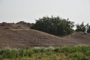
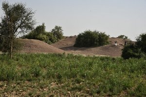
The Kotero/Wahi Pandhi mound is occupied with Muslim period graves with Amrian and Mature Indus pottery scattered on the surface. It was first discovered by N.G Majumadar, during his exploration of Sindh Kohistan.
The mound as recorded by Dr. Louis Flam was 20’ high and the total area of the mound was 12,733 sq.m, but presently the mound is 20’ high from the surrounding plains and the total occupied area is 9798 sq.m, nearly 2935 sq.m area is destroyed due to agricultural activity around the mound (survey of March 2017). The site has suffered considerable ravages at the hands of local people. The mound is situated north of Wahi Pandhi. It stands near Raj Wah (branch of hill torrent Nai Narri or Nalli). This mound is also locally called as Kotero Daro, but N.G Majumadar had named it Wahi Pandhi. He excavated two “trenches” and two “pits” at Wahi Pandhi and claimed the site to be of Neolithic and chalcolithic period. He wrote that the "great antiquity of the site is proved by the black and red Indus pottery, cherty flakes, terracotta bangles, stone lying scattered over the site". In the recent survey in March 2017 by CDC team, it clearly portrays it to be Early and Mature Indus site with the presence of Amrian and Mature Indus cultural material. The cultural material found on surface during thesurvey include: terracotta cakes, bangles, toy cart wheels, balls, lid and horn. Painted and plain pottery of typical Mature Indus and Amrian period was found including perforated jars and some small pieces of copper.
ACCESSIBILITY: The archaeological site of Kotero/Wahi Pandhi is located in Taluka Johi, District Dadu, approximately 2.65 kms north of Wahi Pandhi town.
[Source: CDC-EFT]
Open in Google Map: 26.6795935,67.378815
Copyright © 2019 · All Rights Reserved · Endowment Fund Trust


