Kandir Daro, Badin
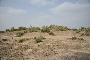
It is a very large site, measuring approximately184 meters in length, 115 meters in breath and about 9 meters high from the surrounding cultivated area. The surface of the mound is undulating and covered with wild shrubs. The north-west part of the mound has been dug by local people and is now in a ruined condition.
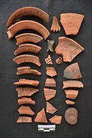
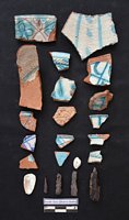
The cultural material scattered over the site clearly belongs to the Islamic period, it includes: plain and painted pottery, black pottery with incised design, glazed pottery, perforated pottery, terracotta broken parts of humble bubble, terracotta grinder for separating husk, brown color sand stone, shells and iron nails. Painting in black in various designs on the rim of the pots is commonly found in the sites of Islamic period in the Badin District along with glazed pottery.
ACCESSIBILITY:
The Kandir Daro is located approximately 8.12 kms south-east of Kario Ghanwar town in Haji Daim Khaskheli village, Taluka Golarchi and District Badin.
[Source: CDC-EFT]
Open in Google Map: 24.7829158,68.6410063
Copyright © 2019 · All Rights Reserved · Endowment Fund Trust


